
Start a Morris Township Street Directory
Use a precise Morris Township address first. Keep the number, street, unit if any, postal city, ZIP, and the date searched together. A postal result is only routing information. It does not confirm who receives mail there, owns the land, or lives there. Morris Township addresses may carry Morristown or Convent Station postal labels, so the address needs a legal-municipality check before a record is assigned to the township.
The most reliable street-by-street path moves from the current parcel key to documents that have their own dates and purposes. The County Tax Board and Morris Township Tax Assessor supply assessment context. County GIS places the parcel on a map. The County Clerk holds recorded instruments. Historical volumes at the library can then supply a time-specific address clue. A current owner, an assessed owner, an occupant, and a person mentioned in an older directory should remain separate labels.
- Run the exact address through the Morris County Tax Board search. Select the current tax year and Morris Township district, then record the displayed block, lot, qualifier, situs address, and assessed owner.
- Open the same address in the Morris County Parcel Searcher. Select the parcel, review its map or report, and note the parcel identifier before looking at nearby lots.
- Use the parcel key or owner name in the Morris County Clerk public index. Compare party, town, lot or block, document type, recording date, and legal-description details before treating an instrument as connected to the address.
- For a recent transfer, compare the Clerk record with the assessment record. The Morris Township assessor says county deed transmission can take at least four weeks after recording, so the two systems may not update together.
- For an older Morris Township address, consult the library's dated directories, newspapers, and maps. Cite the exact volume, page, map sheet, and printed locality rather than converting a historical clue into a present-day claim.
Note: The workflow identifies records associated with land, not a complete list of household members or a guarantee of current occupancy.
Morris Township Tax Board Fields
The Tax Board is the structured starting point when a Morris Township street directory search begins with an address rather than a name. Every panel requires a tax year and district. The location panel uses house number and street, while owner, block/lot, and prior block/lot panels let a searcher approach the same parcel from different directions. The live year and district choices are dynamic, so select them in the portal instead of assuming that a past list remains available.
The property page is an assessment source. It can give the parcel key needed for map and Clerk work, but it does not prove title or current residence. A separate mailing address, if displayed, is tax correspondence information, not an occupancy finding. Record the displayed tax year because assessment fields can change from one cycle to the next.
| Search panel | Required fields | Other fields | Morris Township use |
|---|---|---|---|
| Morris Township property location | Tax year, district, street | House number | Begin one address at a time on a named street. |
| Morris Township owner | Tax year, district, owner | None documented | Test the assessed owner after an address result. |
| Morris Township block and lot | Tax year, district, block, lot | Qualifier code | Carry the parcel key to GIS and Clerk searches. |
| Morris Township prior block and lot | Tax year, district, prior block, prior lot | Prior qualifier code | Check a parcel whose numbering changed over time. |
The County Tax Board search panels show the location, owner, block/lot, and prior-block/lot routes used for a Morris Township address. The screen capture is useful for recognizing the separate panels, but the selected tax year and district remain essential inputs.
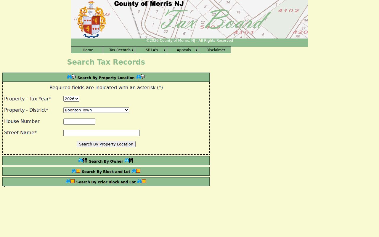
These separate paths make it possible to cross-check a street address with a parcel number without treating an assessment result as a deed.
Morris Township Assessor Requests
The Morris Township Tax Assessor is the route for a property record card and for a 200-foot property-owner list. The office says that the list is supplied by request and payment within seven working days. It is not a web-based neighborhood roster. A property card is an assessment record, and it should be read alongside the tax year, block and lot, and any recorded document that needs verification.
Assessment timing can matter in a Morris Township street search. The assessor distinguishes a finished improvement from a permit closeout, and it distinguishes an assessment update from the recording of a new deed. That is why a recent sale can appear in the Clerk index before an assessment field changes. Preserve the result date and use the clerk's instrument image for the recorded transaction rather than trying to settle a title question with a tax card.
Morris Township GIS Street Context
The GIS viewer gives a Morris Township street directory its map context. Its quick search accepts a municipality, owner, street address, or parcel ID. After selecting a parcel, use the map or report view to inspect the lot and surrounding polygons. The buffer control can help identify nearby parcel geometry, but each selected parcel still needs a Tax Board and Clerk check before an ownership or document statement is made.
Use the viewer to orient a single street, not to create a household inventory. Parcel outlines, map labels, and a buffer are useful for finding the next parcel key. They do not establish a boundary, a legal description, or who occupies a home. The County's own disclaimer makes that distinction clear.
The Morris County GIS Parcel Searcher shows the quick-search and selected-parcel workflow used to move along a street. Its buffer tools can identify nearby parcels for separate verification.
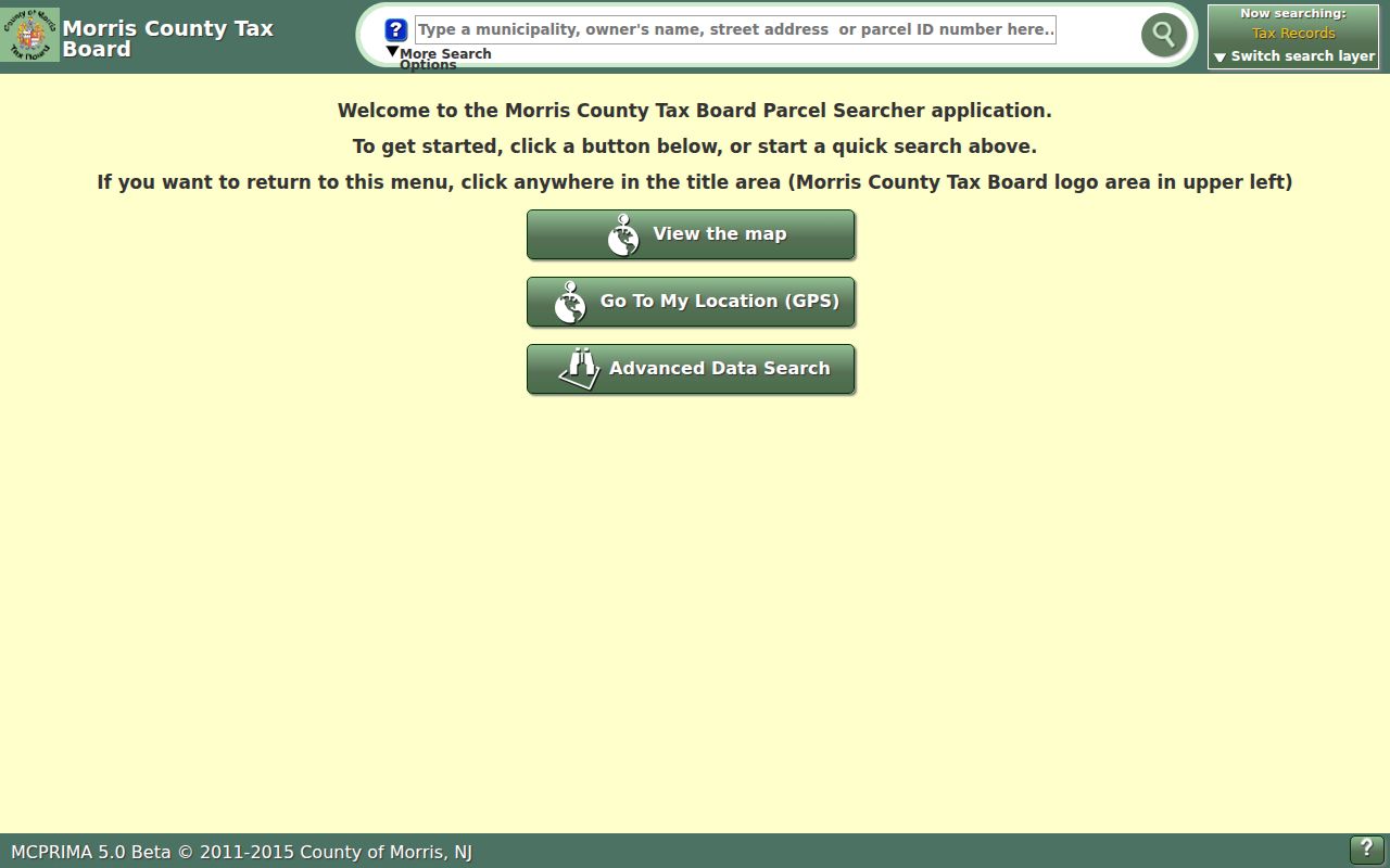
Once a parcel is selected, carry its identifier back to the Tax Board or Clerk instead of relying on the map alone.
Morris Township Postal Name Check
Morris Township is separate from the Town of Morristown even though both names can occur in an address search. The township's physical municipal address uses Morristown, while its mailing address uses Convent Station. Historic records can also use Washington Valley, Pruddentown, or Normandy Park. Those names are useful search terms, but they are not automatic substitutes for the modern legal municipality.
Check the source-stated address against the Tax Board municipality, GIS parcel, and recorded legal description. For older material, preserve the printed locality and add a normalized municipal note only when the record supports it. Around Morristown's 1865 and 1895 separations from the township, test both municipal labels in the Clerk index and in library materials. Convent Station is another worthwhile alternate label when an older result does not appear under the expected postal city.
Note: A postal city helps route mail, while a recorded legal description and parcel record identify the jurisdictional context of land.
Morris Township Deed Trail
The Morris County Clerk is the recorder-equivalent for deeds, mortgages, liens, maps, and related instruments affecting Morris Township land. Its public property-record index is free and is described as reaching back to 1960. The search form supports party name, document type, date range, instrument number, book and page, town, and lot or block. Party-name searching is useful after the address has been tied to a parcel, but a common surname can produce unrelated countywide results.
Read the newest purchase deed, identify the seller or grantor, then search that party as a grantee for the earlier acquisition. Compare the town, lot or block, date, and legal-description text at every turn. Book and page can reconnect a reference from a tax card or estate file. The index may show replacement or correction flags, so inspect the controlling image and do not rely on a results row alone. Older documents and certified or non-watermarked copies route through the Records Vault at 10 Court Street in Morristown, on the first floor, at 973-285-6747, weekdays 8:00 to 4:30.
The Morris County Clerk public search supplies party, document, book-page, town, and lot-block routes for a Morris Township deed trail. It is the index side of the record, not a title opinion.
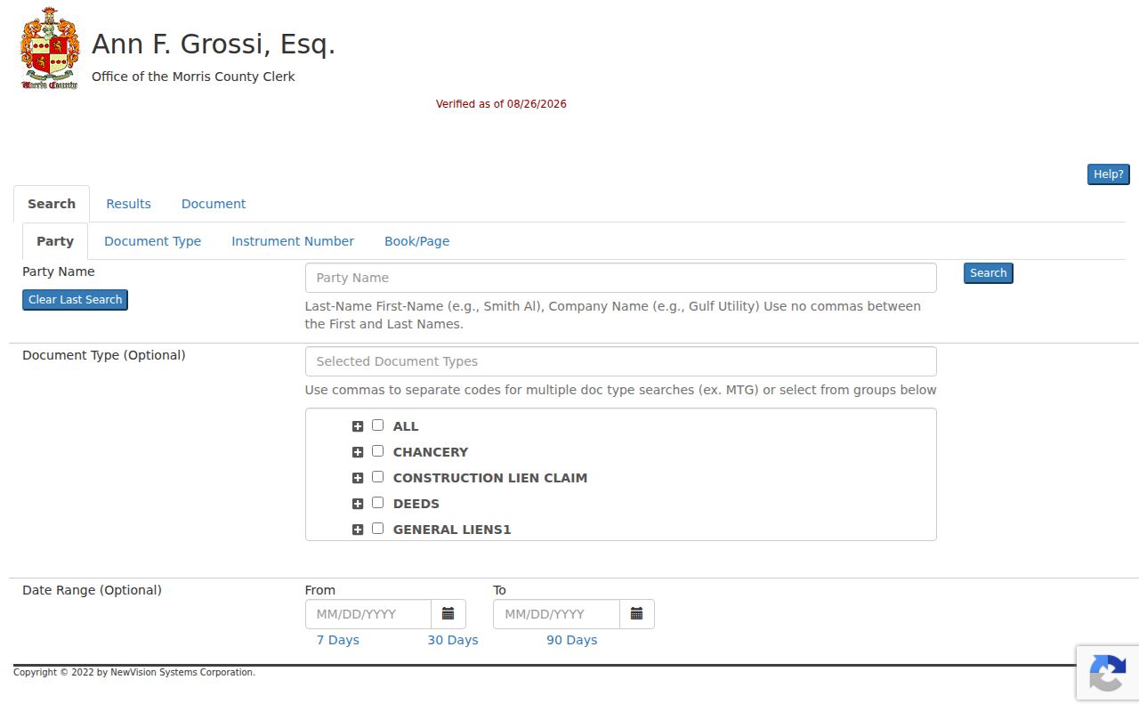
Use the image and parcel details together, then ask the Records Vault about older or certified material when the online cutoff does not reach the needed record.
Morris Township Permit Records
Building, Electrical, Plumbing, and Fire permit material is held by Morris Township Building and Construction Code Enforcement. There is no documented complete public permit index. For a specific address, the department's Building page, its SDL workflow, or an OPRA request are the supported routes. Give the worksite address, block and lot, permit type, and a narrow date range so the request can reach the right records.
An inspection request itself requires a permit number, block, lot, worksite address, and at least 24 hours' notice. That requirement does not make the underlying information a public street listing. A permit can be a property-history lead, while an assessment record can reflect a completed improvement even if permit closeout is separate. Keep those records in their own lanes.
Morris Township Historic Street Labels
A Morris Township street directory becomes historical only when its source has a date. The Morristown & Morris Township Library holds directories, newspapers, maps, and local files that can bridge an older road or locality name to a later parcel search. The library's map holdings include the 1868 Beers, 1887 Robinson, and 1910 Mueller maps, alongside more than 10,000 maps and photographs for Morristown, Morris Township, and Morris County.
No complete official street-renumbering or alias table was located. Do not invent a renumbering year when an old address fails. Compare a directory street entry, the printed locality, map sheet, and deed legal description. Estate-area roads and names tied to Convent Station can be useful historical search anchors, but the result must still be cited by volume, page, sheet, or call number. For historical directory details, use the Morris Township city directory collections rather than treating a single address line as current evidence.
Morris Township Street Record Coverage
No one office keeps a complete Morris Township street directory. Each record set is keyed to a different purpose and has its own access path. The coverage below keeps assessment, mapping, recorded documents, municipal permit work, and historical occupants separate. It also shows why the best address search uses more than one official source.
| Address-keyed record | Keeper | What it can show | Access path |
|---|---|---|---|
| Tax and assessment result | Morris County Tax Board and township assessor | Tax year, parcel key, assessed owner, and assessment context | Online Tax Board search; card or 200-foot list through assessor |
| Parcel map | Morris County GIS | Polygon, map or report, and nearby parcel context | Online Parcel Searcher; data are not a survey |
| Recorded instrument | Morris County Clerk | Grantor, grantee, document date, and legal description | Free online index generally from 1960; Records Vault for older or certified material |
| Permit or inspection | Morris Township Building | Address, block/lot, permit, inspection, or certificate trail | Department, SDL route, or focused OPRA request |
| Historical directory or map | Morristown & Morris Township Library | Time-specific occupant, business, address, or locality clue | Reading room, databases, microfilm, or requested materials |
County voter status is an individual service, not an unrestricted street roster. Likewise, an assessed owner may be an entity, estate, or person whose mailing address differs from the parcel. Read the displayed field for what it actually says.
Note: Preserve the custodian, query, source date, and limitation for every Morris Township address result before comparing it with another record.
Morris Township Street Terms
Address research crosses assessment, map, recording, and historical-library vocabulary. A small vocabulary check prevents a searcher from turning a location field into proof of residence or title.
- Parcel
- A mapped land unit identified by a local parcel key, often including block, lot, and qualifier information.
- Situs address
- The physical property location. It can differ from the mailing address used for tax correspondence.
- Legal description
- The land description used in a recorded instrument. It is not replaced by a postal address or GIS outline.
- Criss-cross directory
- A historical directory arranged by street and number rather than only by name, when that feature appears in a particular volume.
The definitions make it easier to label a Morris Township record accurately. They also make a handoff to the Assessor, Clerk, or library staff more precise when an online result does not answer the question.
Morris Township Street Directory Limits
A Morris Township street directory cannot reliably show every non-owner occupant, household member, utility customer, delivery recipient, or current occupant. A property owner may not live onsite. Motor-vehicle address data are restricted, and public voter status does not create a block roster. A historical directory can show a dated printed entry, not a current household fact. A missing result can reflect a different custodian, a different address label, a restricted field, or an unsearched time period.
Some addresses are protected through New Jersey's Address Confidentiality Program. Court, police, and other records can also contain restricted material. Use official sources for lawful personal research, respect access rules and redactions, and avoid combining records merely because names or addresses appear similar.